Critical piece of biodiversity land supporting Canada’s goal of conserving 30% of land and water by 2030.
Property Overview
Corbin Road Land Company is a privately owned company.
Land and potential transformation will fit within the Canadian and British Columbian government’s mandate to conserve 30% of land and water by 2030 to reverse a decline in biodiversity, better fight climate change, and maintain a strong, sustainable economy.
Our vision is to implement a variety of nature-based services in partnership with First Nations to maintain and enhance co-benefits from the land including biodiversity and connectivity.
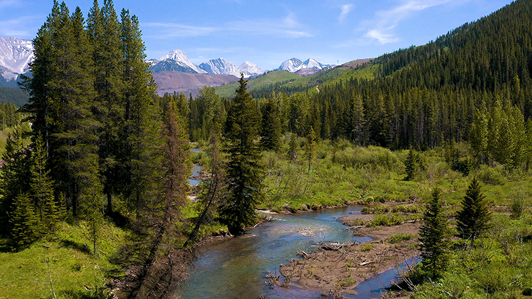
Property Size: 19,000 acres.
Elevation: 1,300 to 2,300 metres above sea level.
Access: Primary road access to the general area is via the Crowsnest Highway (Highway 3).
Climate: Local climate is characterized by long, cold winters and short, cool to hot summers.
Land Use: Timber harvesting, exploration, energy, and recreational.
Location
Nestled in the Elk Valley, British Columbia, and neighboring the Crowsnest Pass in Alberta, the property occupies a position within the northwest-trending front ranges of the Rocky Mountain physiographic region.
This region is distinguished by a succession of steep mountains that extend to the northwest, intersected by west-flowing streams.
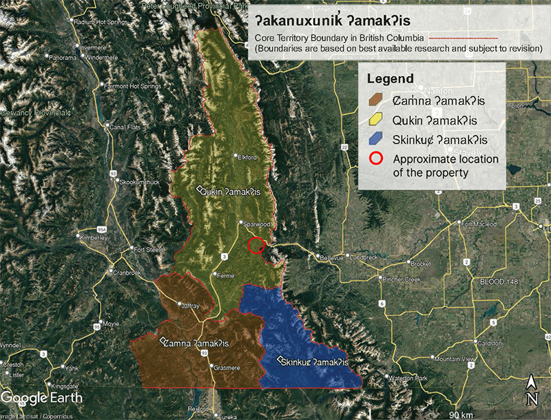
First Nations
Corbin Road acknowledges that this land is within the asserted traditional territory of the Ktunaxa Nation and may also be of interest to other Bands and Nations.
Corbin Road is committed to working with the leadership and knowledge-holders of the Ktunaxa Nation and other Bands and Nations regarding their interests, concerns, and values.
Human activity plays a major role in the overall health of all living things on our planet. We recognize the Property is culturally sensitive land and we have a strong desire to work in partnership with local First Nations to return the land to its traditional use.
Biodiversity
Over the last several years, widespread realization that natural systems are precious and limited has occurred and change has begun to influence and potentially alter human values towards the world around us.
There is greater awareness about how human behavior and actions can degrade the health, functionality, and integrity of sensitive and valuable ecosystems.
Urgency is needed to maintain and grow natural systems through responsible and sustainable development, and ecological restoration to repair what impacts have occurred.
Our land consists of varied and significant components of biodiversity that when integrated and improved, will have material impacts on surrounding environments.
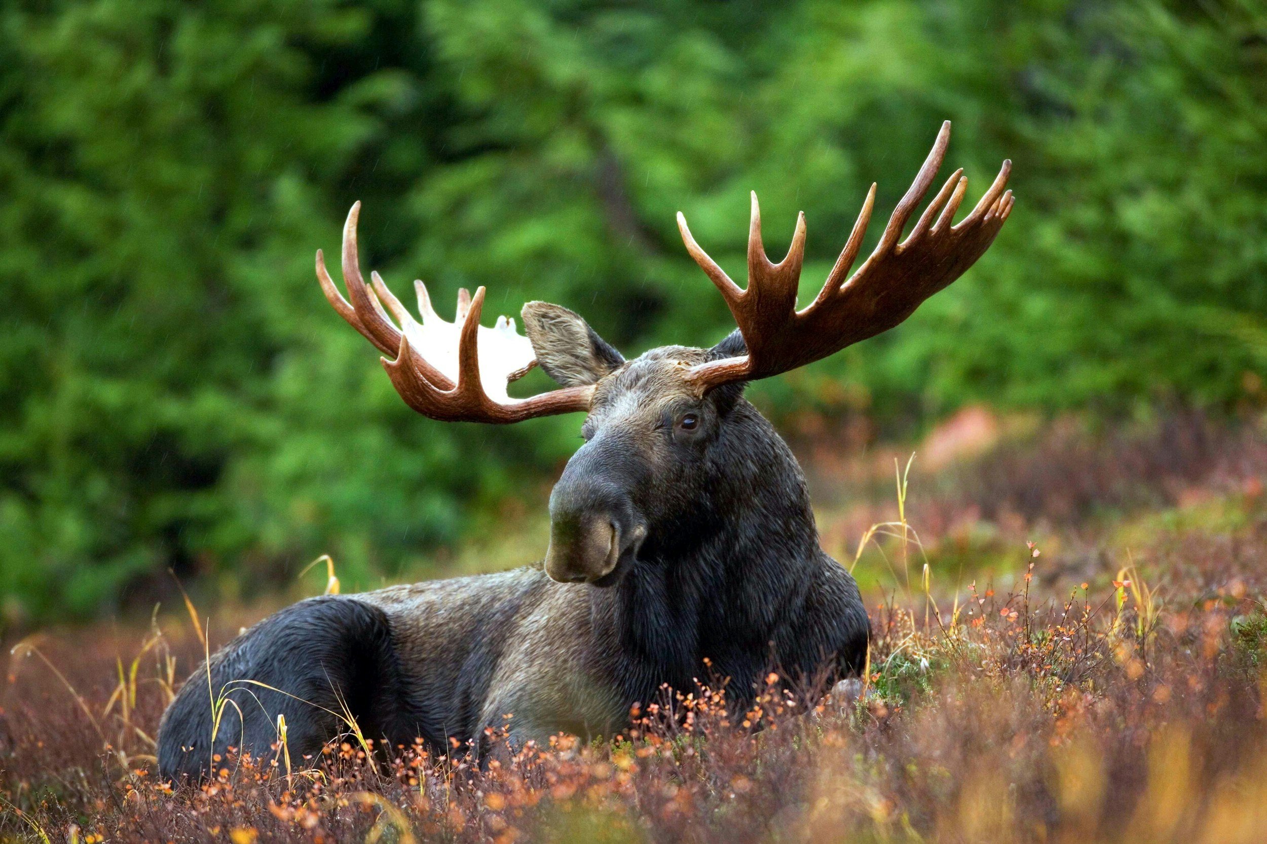
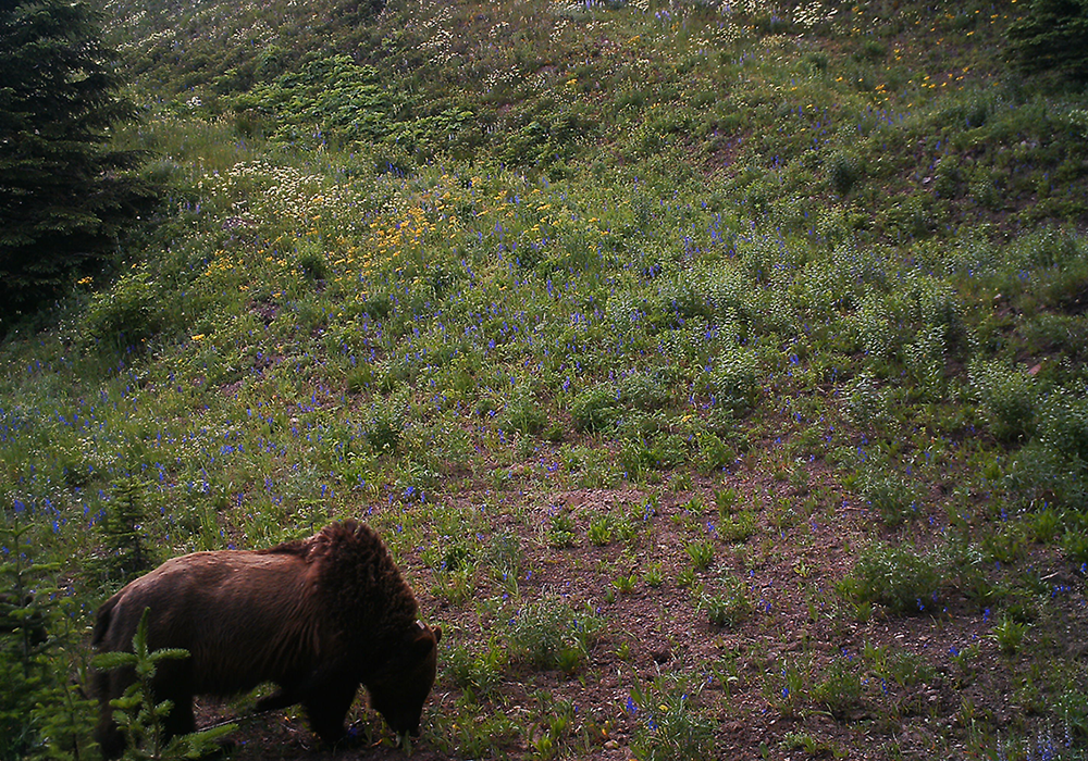
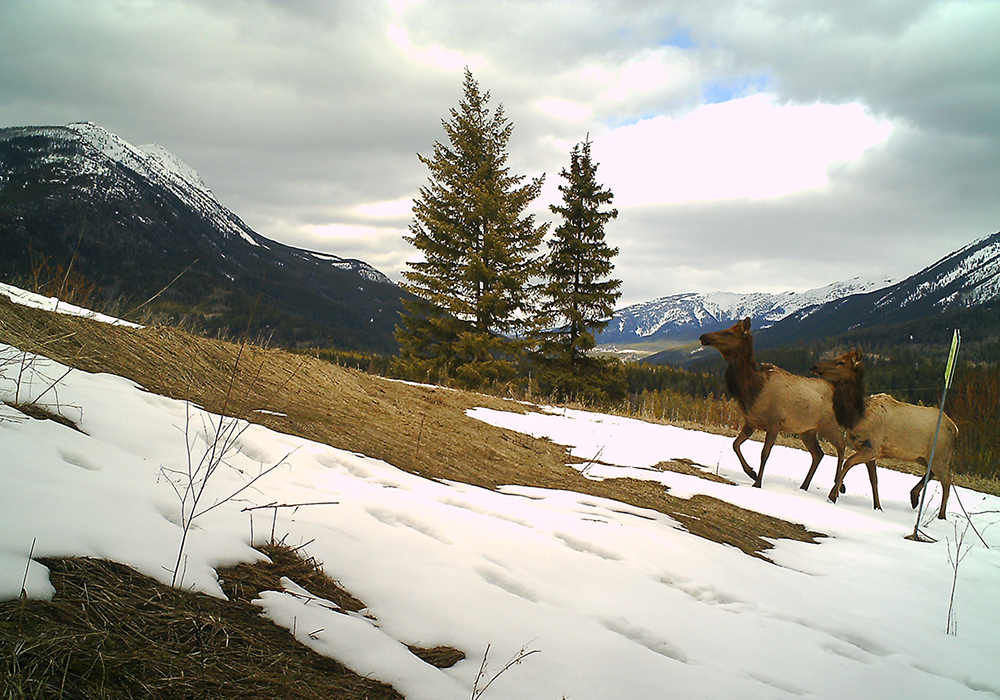
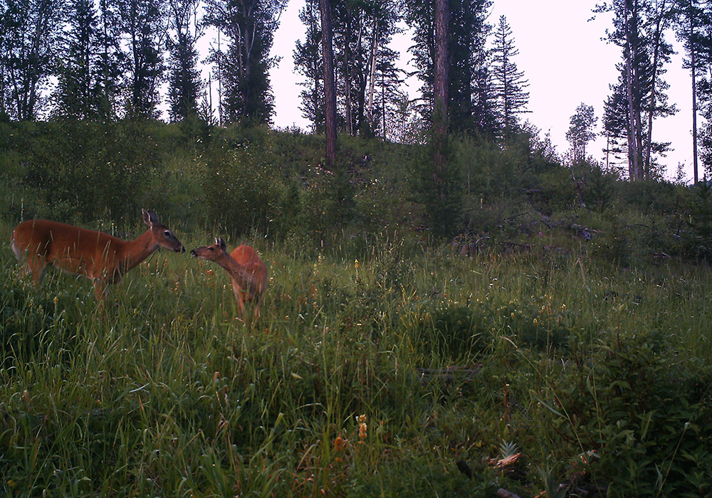
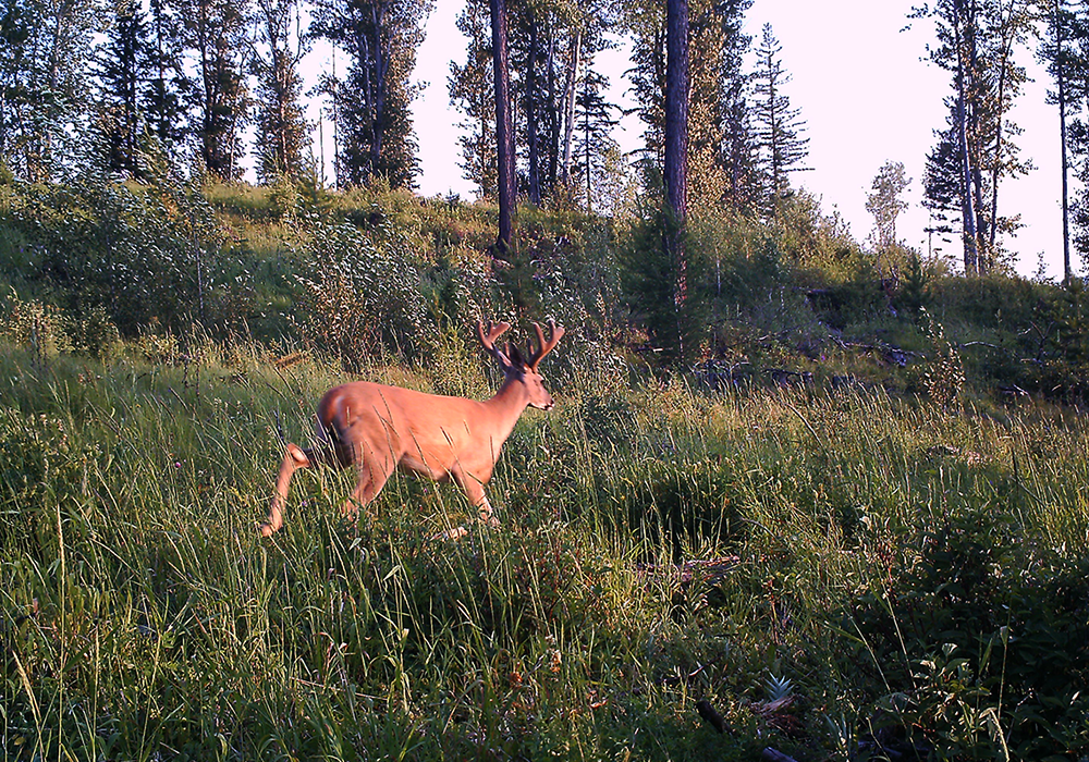
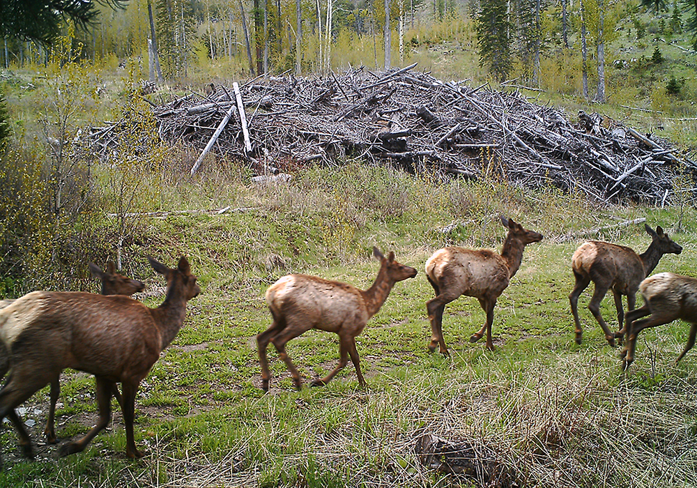
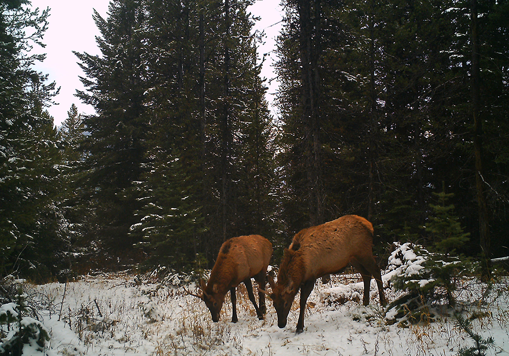
Animals
Expert third parties have conducted numerous baseline studies and reports, quantifying and measuring the diversity and variety of species and ecosystems on the property and surrounding area.
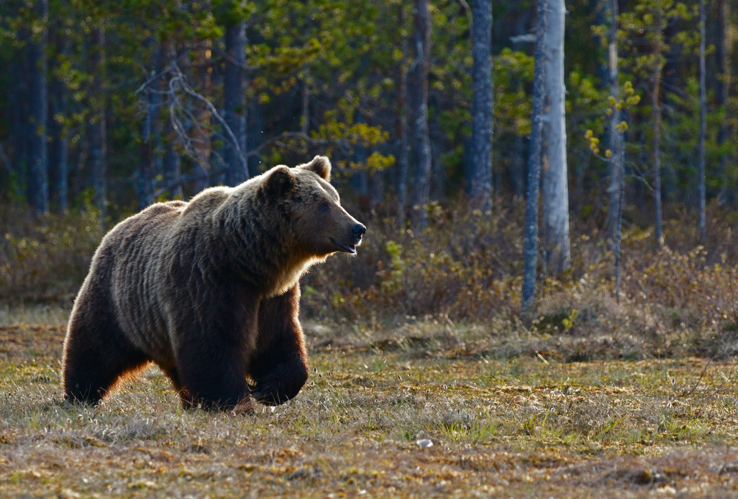
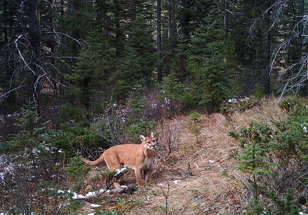
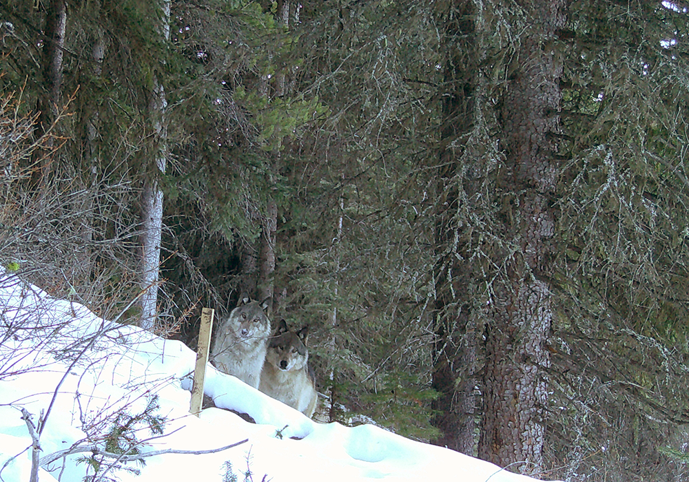
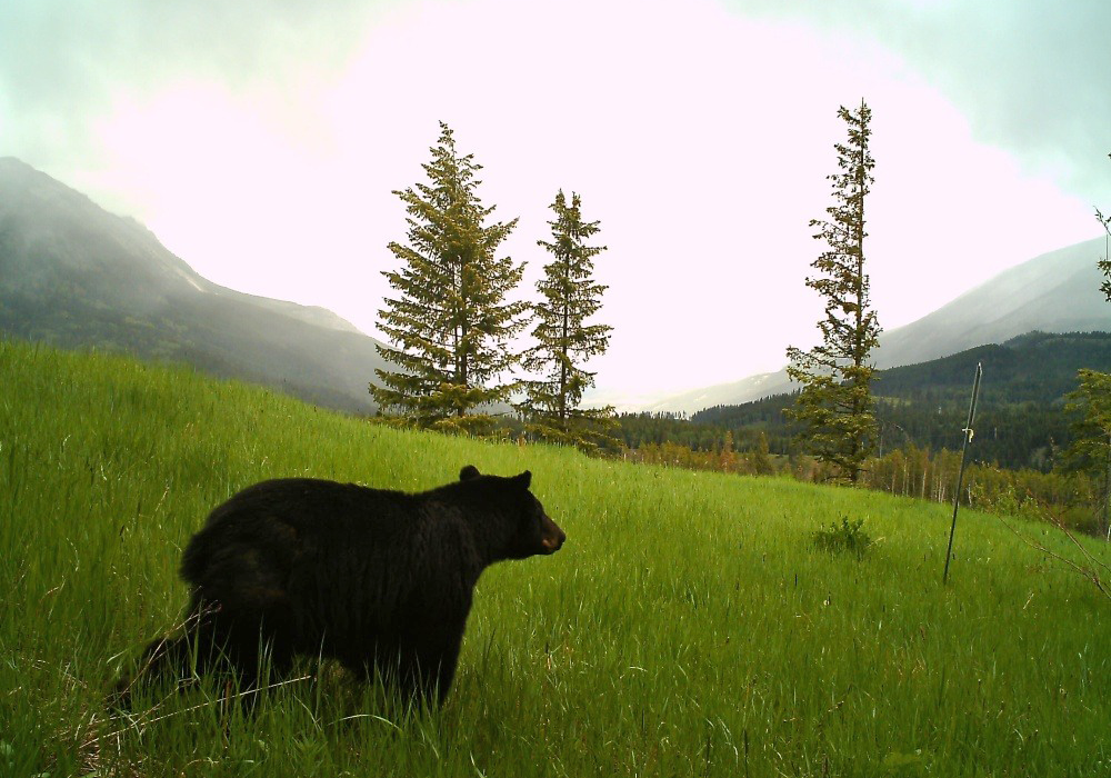
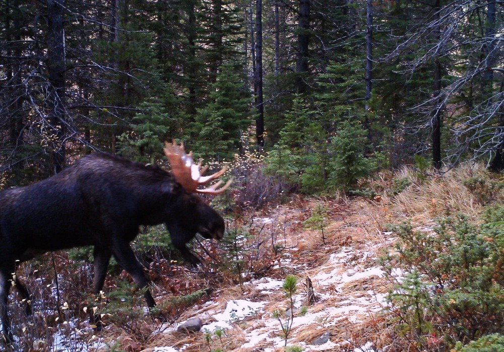
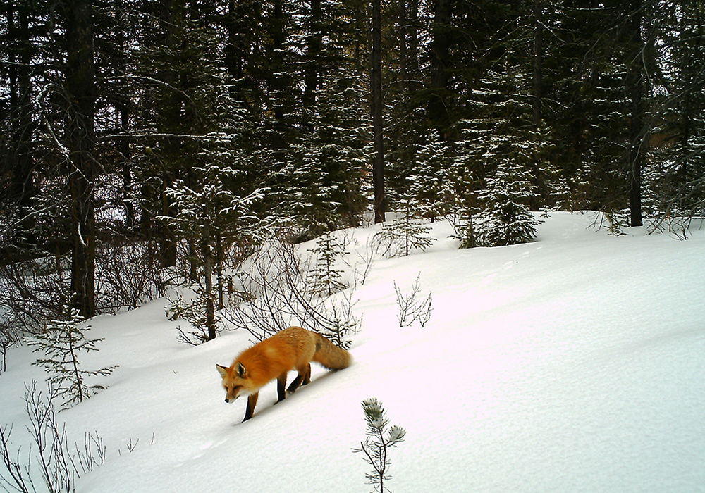
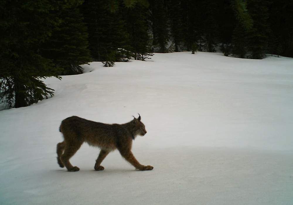
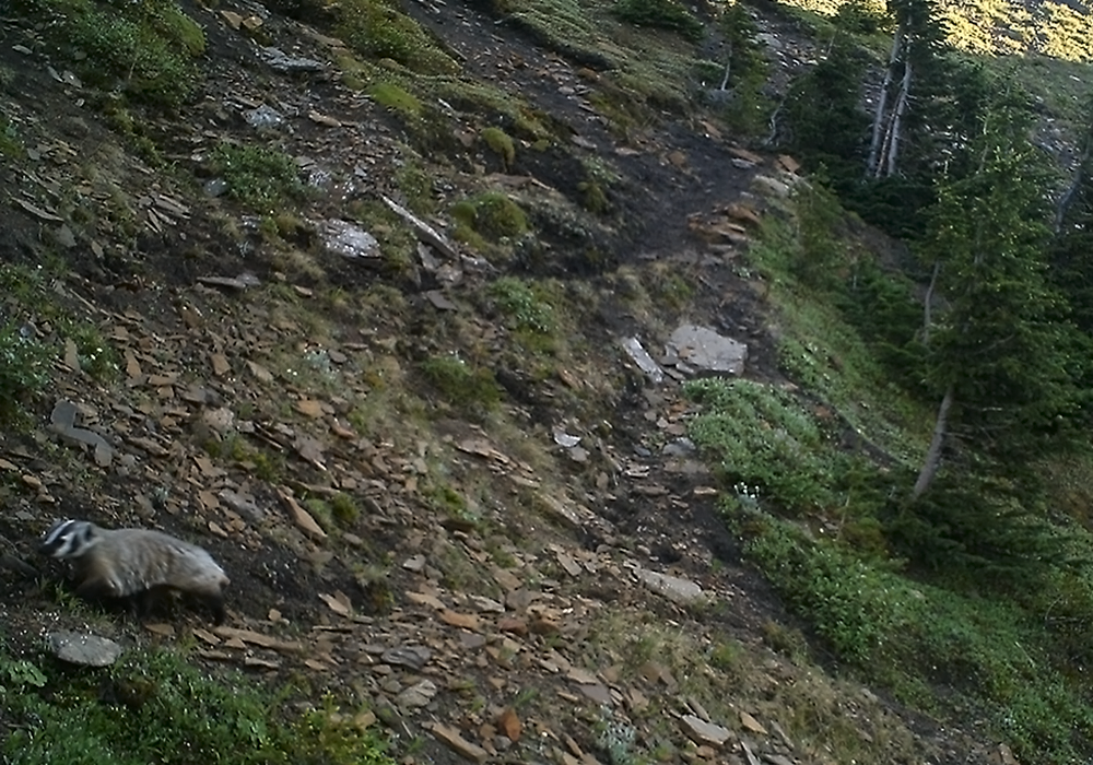
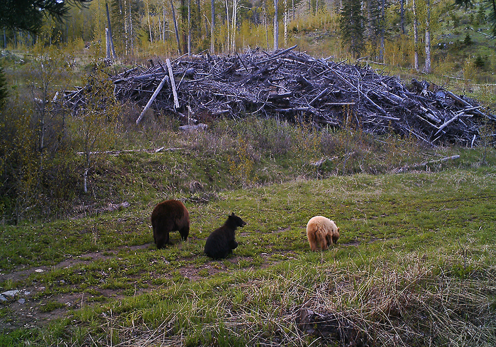
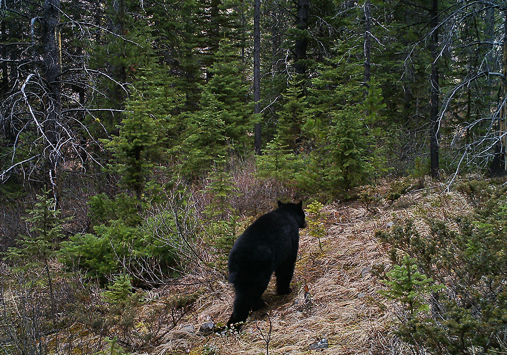
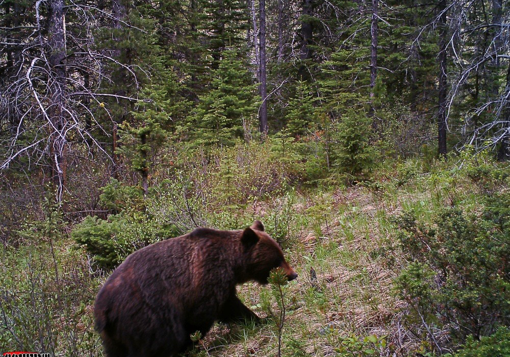
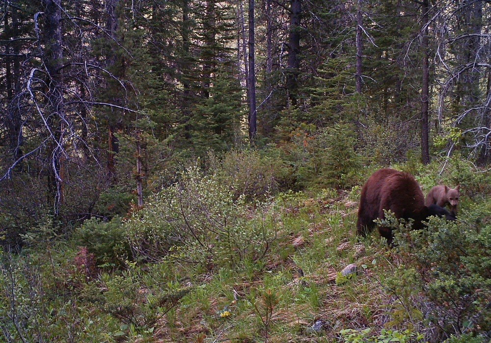
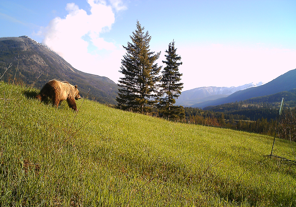
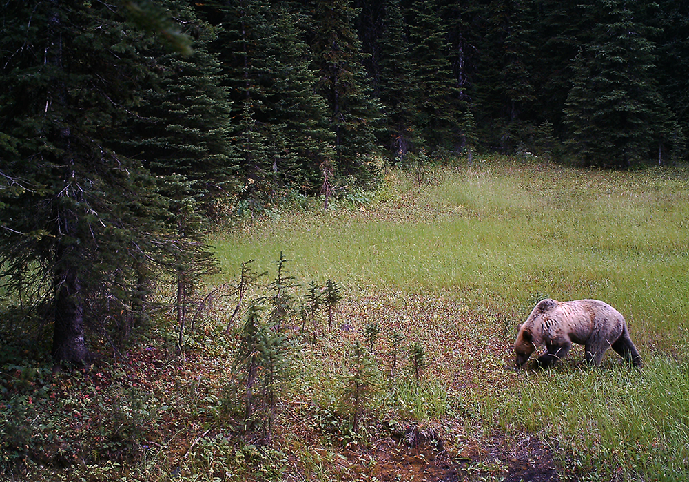
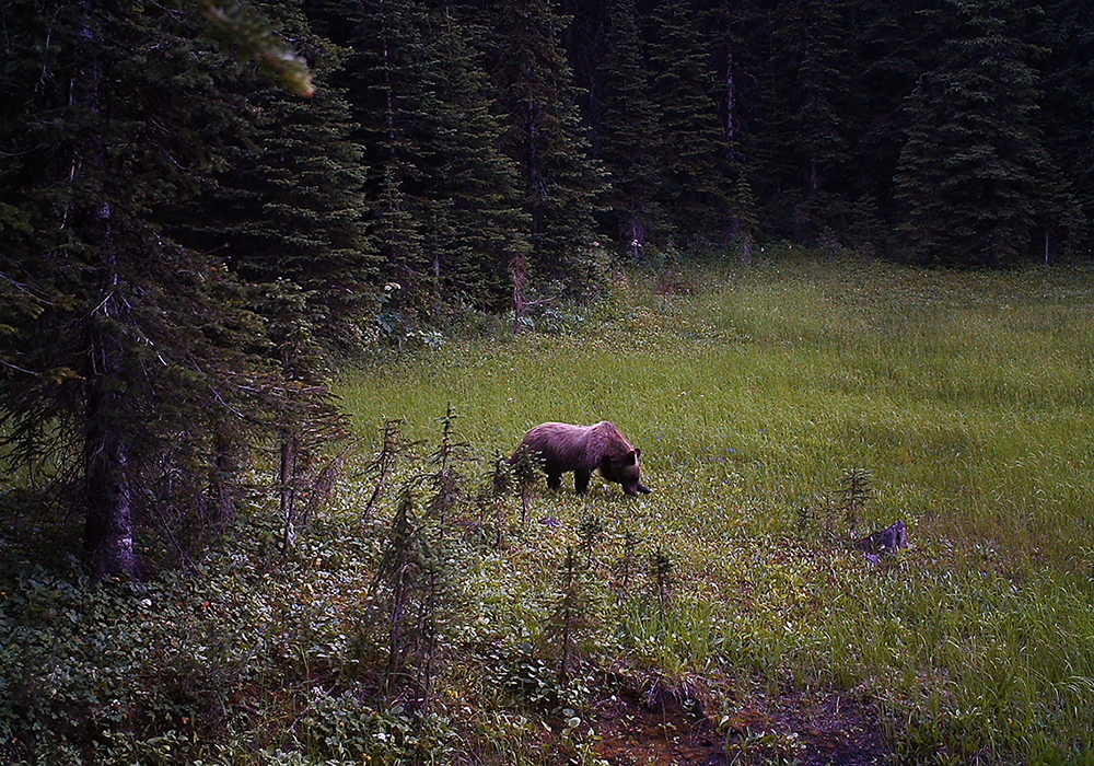
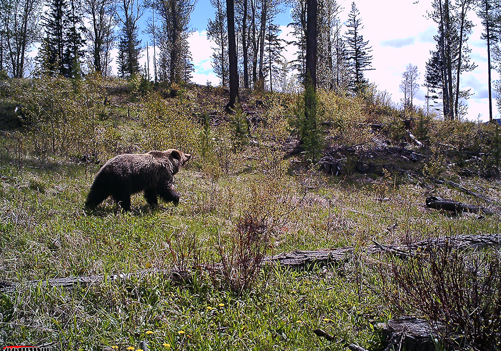
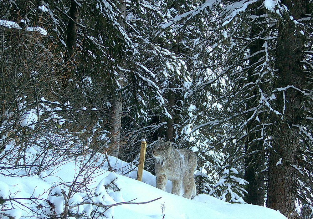
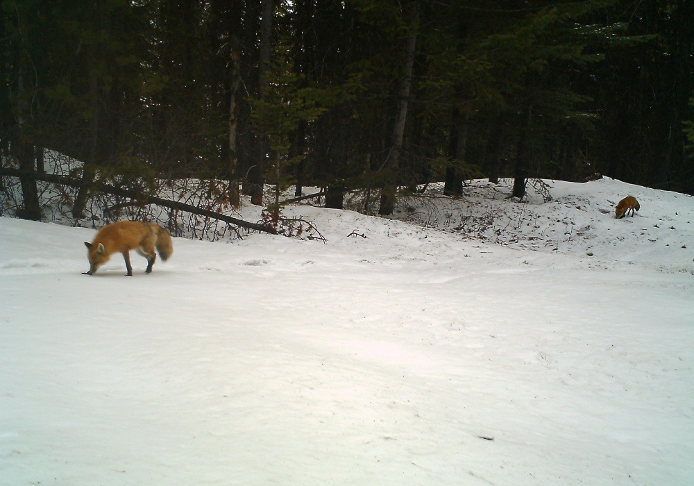
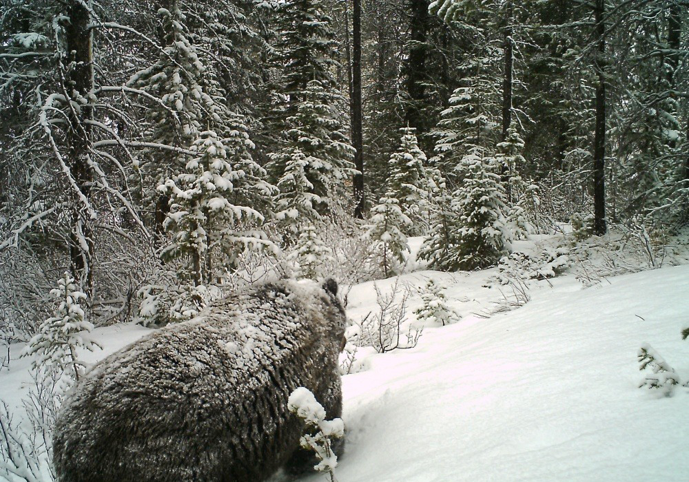
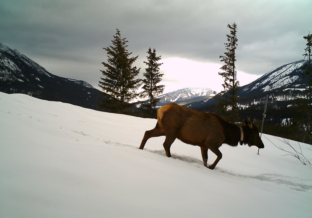
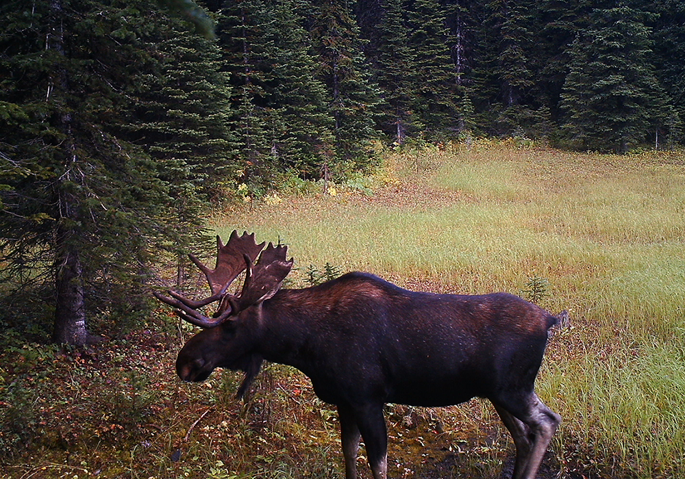
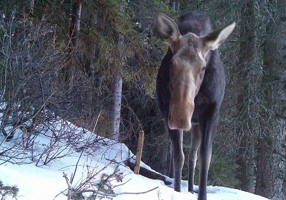
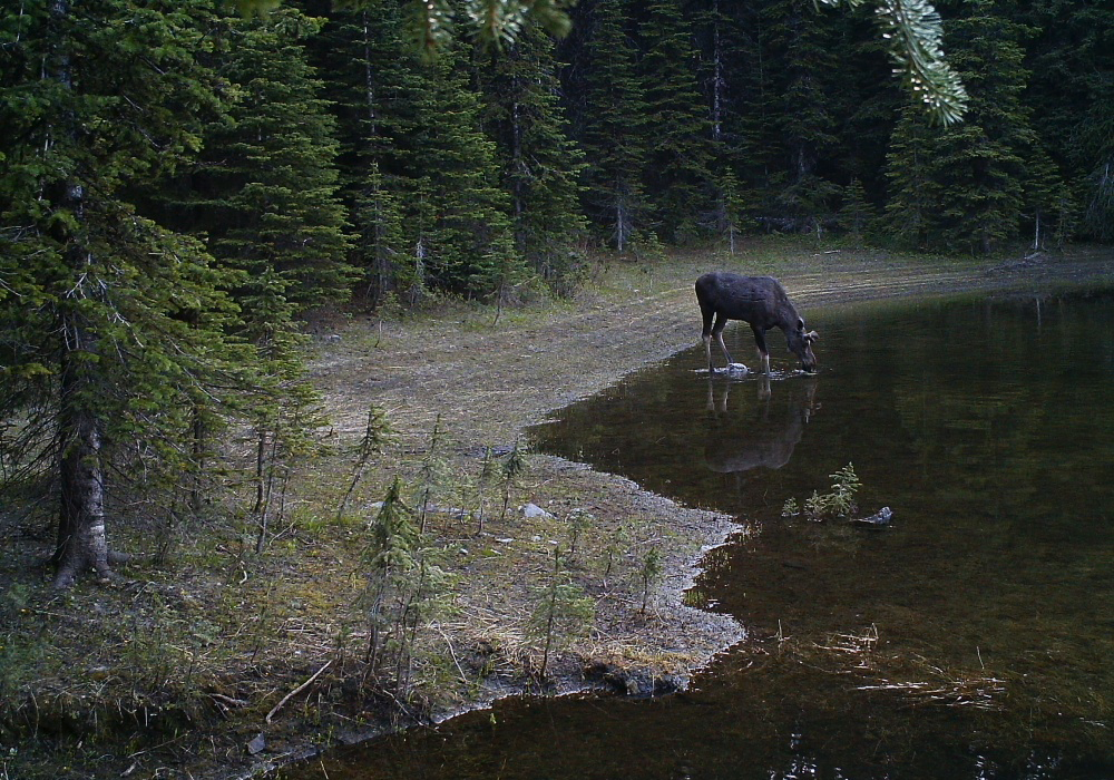
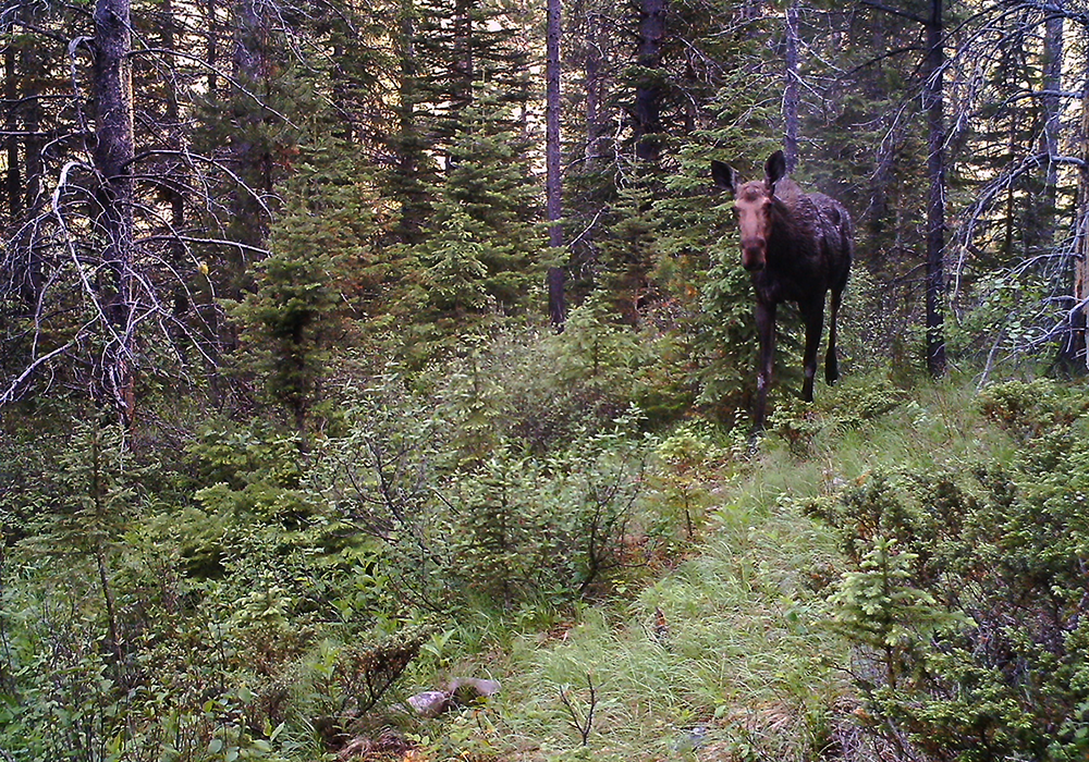
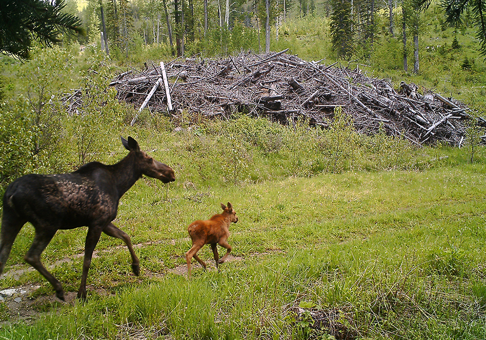
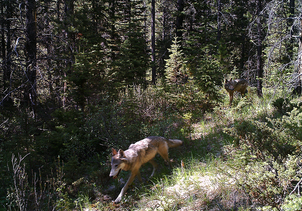
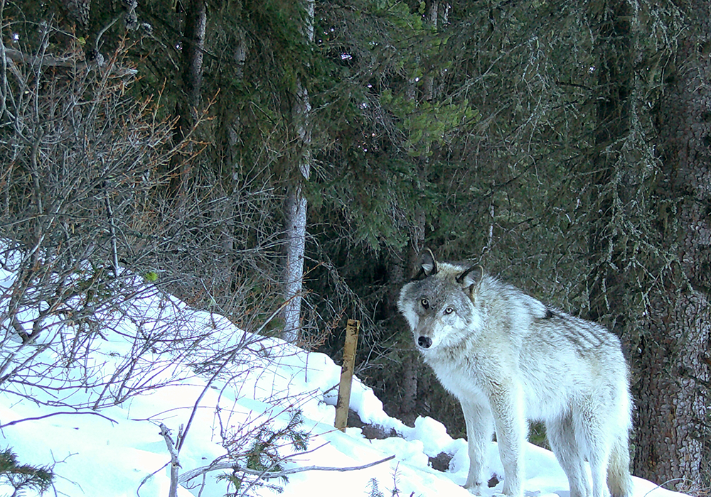
Property hosts many species of concern as designated by Canada’s Species at Risk Act, including umbrella species such as bear and wolf, living across seven sensitive ecosystems.
Wildlife is continuously monitored from 12 cameras on site.
Company actively participates in various wildlife initiatives and programs.
Migratory Pathways
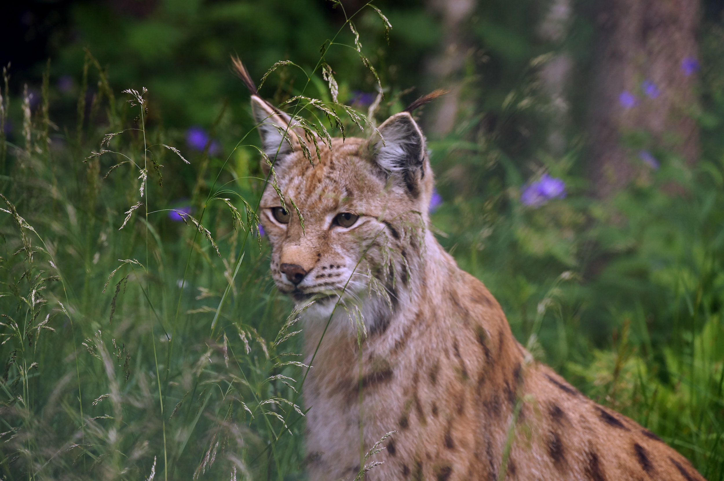
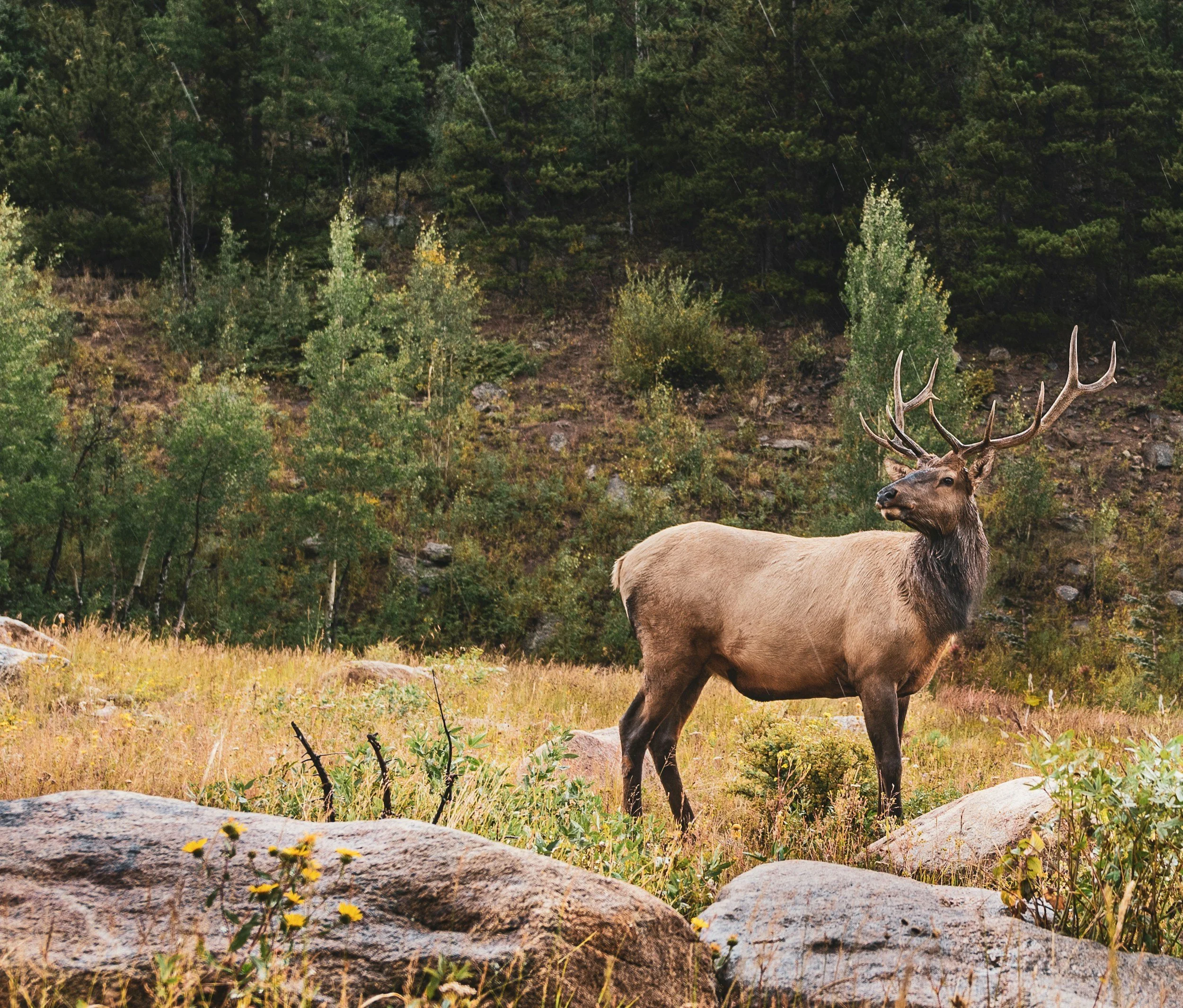
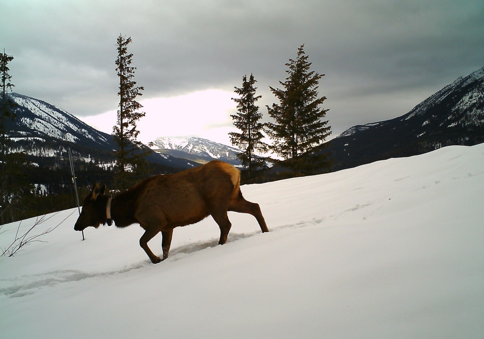
Elk Valley plays a crucial role in facilitating the north-south and east-west movement of a diverse range of wildlife, preventing fragmentation among sensitive species like grizzly bears, wolverines, lynx, and wolves. Additionally, it supports the local movement of valued ungulates such as deer and elk.
Property is positioned along the Pacific flyway, a prominent migratory route for birds in the Americas stretching from Alaska to Patagonia, supporting substantial north-south movement of species.
Located within the Yellowstone to Yukon Conservation Initiative, which is committed to ensuring the long-term ecological health of the region.
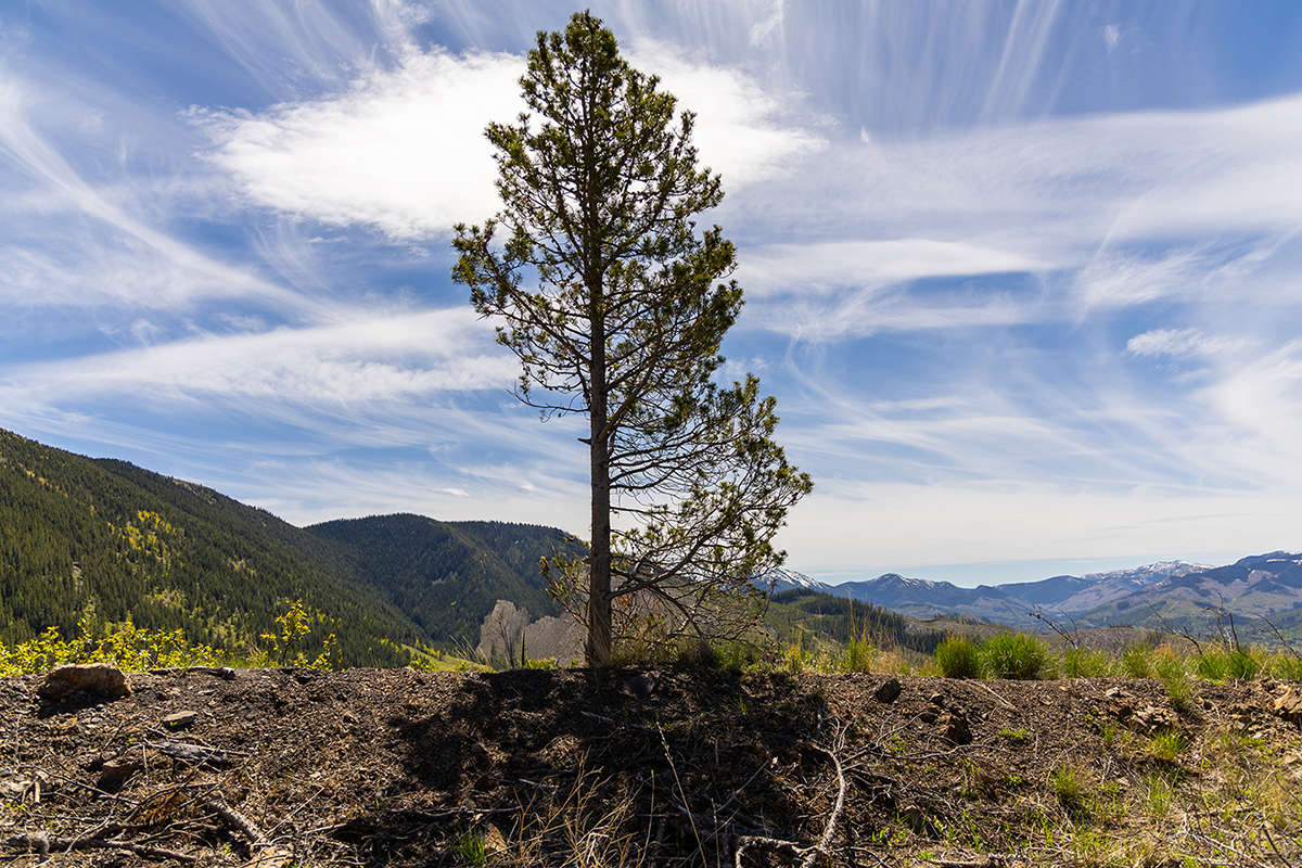
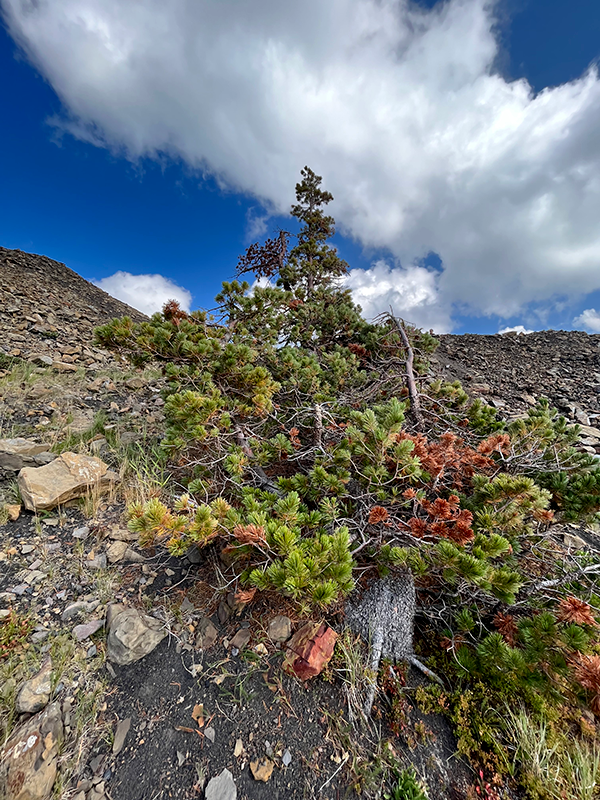
Vegetation
Property includes four biogeoclimatic units:
Dry warm Montane Spruce subzone.
Elk dry cool Engelmann Spruce–Subalpine Fir variant.
Dry cool woodland Engelmann Spruce–Subalpine Fir subzone.
Dry cool parkland Engelmann Spruce–Subalpine Fir subzone.
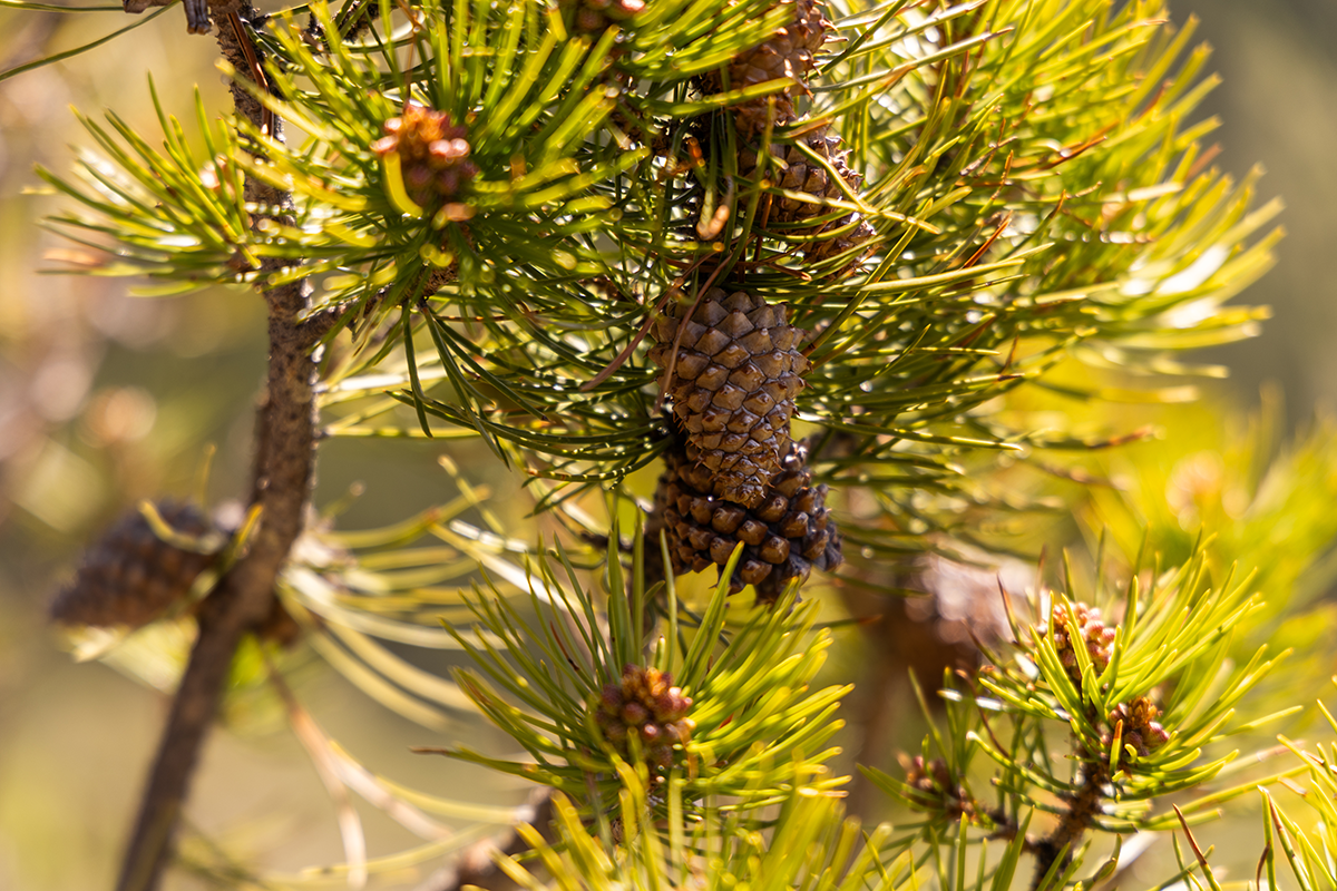
Plant species at risk or designated as extirpated, endangered, threatened and of special concern by the Committee on the Status of Endangered Wildlife in Canada and/or identified as blue or red-listed by the British Columbia Conservation Data Centre, that have been confirmed to occur within the property include:
Limber Pine (Pinus flexilis).
Whitebark pine (Pinus albicaulis).
Parry’s townsendia (Townsendia parryi).
Bryum moss (Bryum calobryoides).
Arizona calcareous moss (Mnium arizonicum).
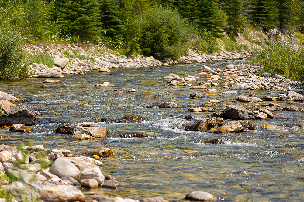
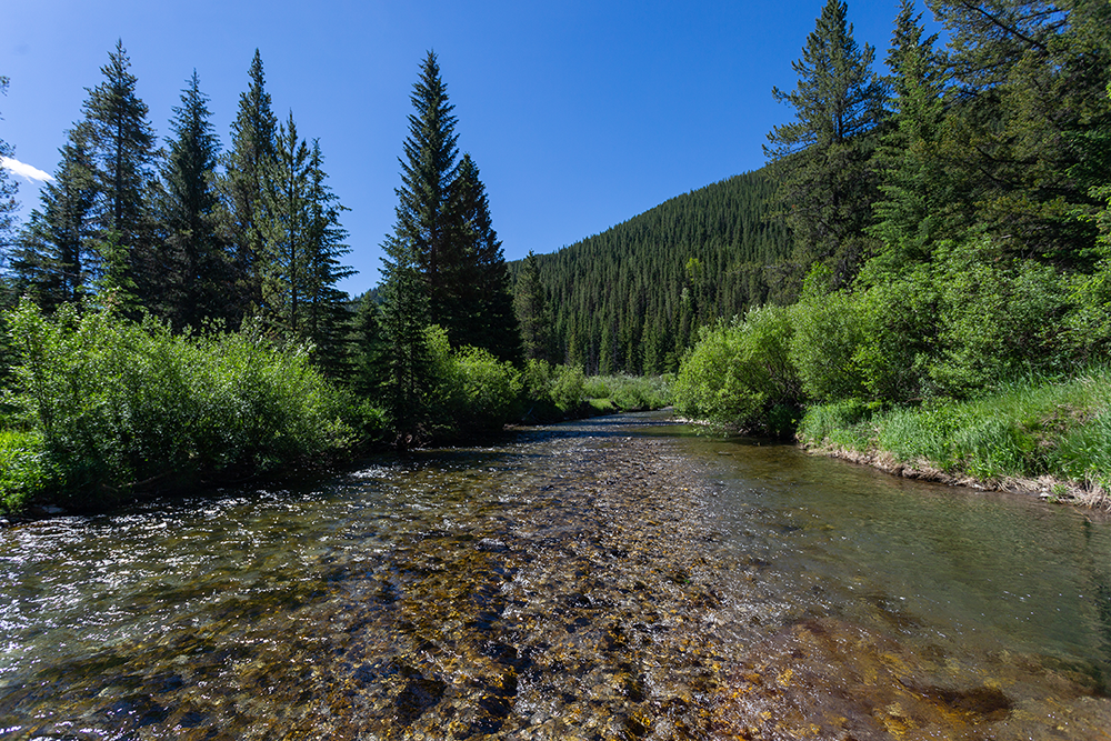
Water
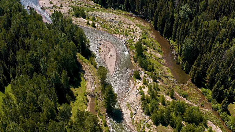
The vitality of fish habitat relies on the abundance and interconnectedness of waterways. The Elk River shapes a lengthy, narrow valley, descending from an elevation of approximately 1,700 metres to 720 metres at its mouth.
Within this hydrologically dynamic system, several tributaries, including the notable Michel Creek, contribute to the flow of the Elk River.
Wildlife Photos from the Property
Affiliates:
Corbin Road Land Company possesses access to a wealth of extensive data amassed and analyzed since 2013. This valuable information stems from our affiliated company and well recognized experts in the region which have diligently conducted comprehensive baseline studies encompassing wildlife, vegetation, soils, waterways, groundwater, habitat, socioeconomic factors, air quality, and terrain.